Villa at the ENEL plant
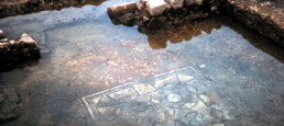
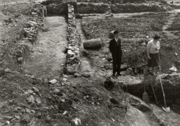
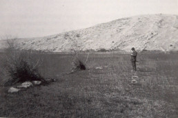
Nel 1965 la Soprintendenza alle Antichità delle Venezie indagò quel che rimaneva della villa, già individuata tra la fine dell’Ottocento e i primi del Novecento da Alberto Puschi e distrutta, nel corso della prima metà del Novecento, dalla costruzione della statale 14 e successivamente da quella della centrale ENEL.
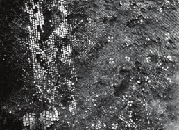
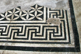
The investigation brought to light mosaic walls and floors. Of this villa, unfortunately, only photographic evidence remains: one of these relates to a room paved with a black mosaic with white crosses that finds comparisons with similar decorations attested in some Roman villas in the area dated to the second half of the first century BC.
Villa of the Point
The large complex, located on the island that formerly faced the mouth of the Timavo River, was investigated in the early 1970s.
It featured about 30 rooms arranged around a central courtyard.
To the north and northeast, in the residential wing, some rooms had floors decorated with black-and-white geometric mosaics; to the west was probably located the rustic part of the villa where production activities took place. The discovery of an olive press and stone elements traceable to a press seems to confirm this attribution.
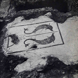
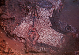
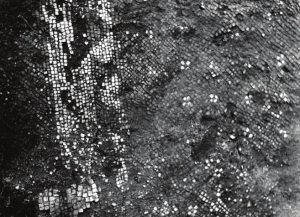
A series of compartments, moreover, has been hypothetically interpreted as a thermal area. A mosaic with a central panel depicting two black dolphins facing a trident was found here.
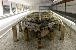
These rooms opened onto a courtyard overlooking the lagoon; a boat was exceptionally found nearby. It, due to the construction technique employed ("mortise and tenon") was intended for use on the open sea.
Of the boat, datable like the residential building between the second half of the 1st century B.C. and the 2nd century A.D., the bottom was preserved, almost in its entirety (11 x 3.8 meters).
It is possible that it was used for the commercial distribution of the villa's products (oil, wine, fish sauces?). A number of everyday objects that were used on board were found inside the hull: ceramic vessels, a wicker basket and a wooden vessel containing grapes.
The wreck is now in the National Archaeological Museum in Aquileia.
Villa dei Tavoloni
Even of this villa, which was investigated several times between the 1950s and 1970s, nothing remains visible today.
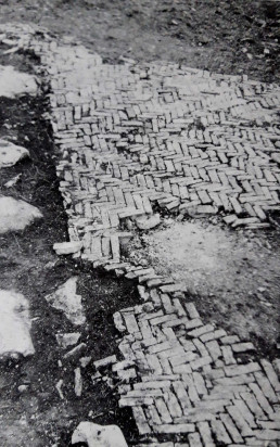
From the excavation reports and photographic documentation it is assumed that the rustic part was characterized by a series of rooms arranged around a courtyard paved in cocciopesto and decorated with fragments of river pebbles.
Other rooms had wrought and terracotta tile floors arranged in a herringbone pattern (opus spicatum). Based on the archaeological materials found, it is possible to establish that the villa was inhabited from the second half of the 1st century BC to the 1st century AD.
Other structures of unclear interpretation brought to light in the surrounding area in the early twentieth century (perhaps a cistern, an enclosure wall, and a small pier) are probably to be related to the Tavoloni villa.
Roman baths of Monfalcone
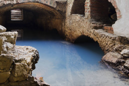
The territory defined in antiquity Lacus Timavi was known for the presence of sulfurous waters that still flow from underground and are exploited by the modern spa facilities in Monfalcone.
The main source, with temperature around 40°, was located in the western part of the greater of the insulae clarae, small islands that in Roman times were facing the coastal area of the Timavo Straits. This island, characterized by two highlands joined by an isthmus, seemed to split into two parts as the tide rose; the larger of them in modern times took the name St. Anthony's Hill, the other, where a spring of warmer thermal water gushed out, was called Punta Island.
Today these islands are found completely silted up due to both the gradual swamping of the coastal area and man-made land reclamation.
Despite the fact that memory of the presence of the ancient baths had never been lost, and despite the numerous scientific researches conducted in the area since the late 19th century, it is still difficult to reconstruct the actual articulation and extent of the Roman-era thermal facility, due to the continuous superimposition of other buildings with the same function over the centuries.
Excavations conducted in the area in 1911 led to the discovery of rooms paved in terracotta and partly frescoed and a courtyard bordered on two sides by a portico. More recent archaeological investigations have brought new data to the understanding of the ancient baths, which were active between the end of the first century B.C. and the third century A.D.
Of considerable interest is the discovery of a marble statuette of a sleeping Erote that was probably part of the decorative apparatus of the bath complex.
The villa of Casale Rondon
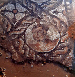
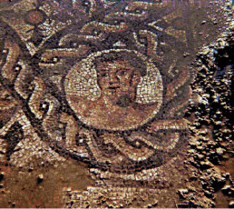
In the territory of San Canzian d'Isonzo, about two kilometers south of today's settlement, where the medieval mill of Rondon stood, fragments of a richly decorated polychrome mosaic floor, referable to the first half of the 3rd century A.D.The mosaic is documented only by photographs taken at the time of its discovery and was covered soon after by buildings of agricultural use.
It featured depictions of busts of athletes alternating with captions in Greek, enclosed in circular fields bordered by two-headed braids.
One section of the floor was decorated with a marine scene, very lacunar, of which only part of a cupid and a sea monster were preserved.
Although there is a lack of data on the structures and their extent, scholars believe that these mosaics were part of a large residential complex of the highest level equipped with baths, since the association of figures of athletes and marine scenes finds comparison with typical decorations in Roman-era bathhouse environments.
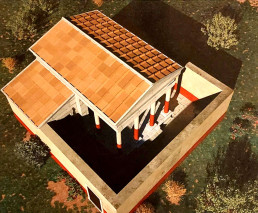
The Roman villa of Staranzano
Known as the "villa della liberta Peticia," the villa at Staranzano was one of the residences with a residential and productive character in the territory that in ancient times was administered by Aquileia.It was located along the Roman road that led from Aquileia to Tergeste (Trieste) and in the vicinity of a waterway, perhaps a branch of the Isonzo River that has disappeared today.
Like the other "ville rustiches" of the Roman period, the villa gravitated to a landed estate (fundus) where various economic activities were carried out, from which the owner and his family drew sustenance and products to market. These complexes consisted of a residential part (pars urbana) and a purely productive part (pars rustica).
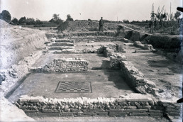
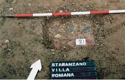
The Staranzano villa was discovered by chance in 1955 on land owned by the parish church during work to modernize the sewage system. Archaeological excavations, conducted by Valnea Scrinari on behalf of the Venetian Superintendence of Antiquities, brought to light only the southeastern corner of the building, at a depth of about 80 cm from ground level and covering an area of about 130 sq. m.
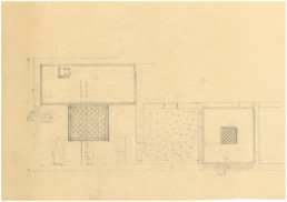
From these early investigations remain the notes and sketches that Giovanni Battista Brusin, archaeologist and director of the Archaeological Museum of Aquileia from 1922 to 1952, recorded in his diaries. Other limited surveys and restoration and conservation work on the structures were carried out in 2002 and 2008 by the Soprintendenza per i Beni Archeologici del Friuli Venezia Giulia.
The size of the villa is currently unknown. Recent geoarchaeological investigations carried out in 2022 as part of the "E-VILLAE" project promoted by the Municipality of Staranzano have made it possible to identify, to the southeast of the already excavated complex, traces of at least two rooms probably pertaining to the villa but not physically connected to the residential part.
The first building of the complex is dated to the second half of the 1st century BC. Based on archaeological data, we know that between the 1st and 2nd centuries AD changes were made to the building during at least two phases of renovation.
The villa was inhabited until the beginning of the third century AD. Renovations involved not only changes in the size of the rooms, but also the use of different building materials in the masonry: the earliest phase saw the use of river pebbles, while in more recent ones brick fragments and tiles were also used. The latter were often stamped with trademarks referring to well-known local manufacturers.
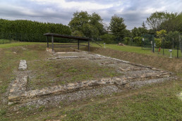
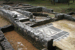
The 1955 excavation brought to light three identical rooms, paved in opus caementicium (beaten mortar incorporating flakes of stones of different colors), placed side by side and facing a long and narrow room, perhaps a courtyard, referable to the first building phase.
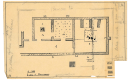
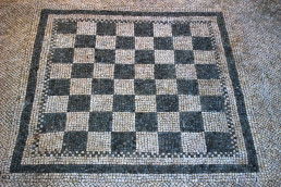
During the first renovation, the room to the southeast (A) was considerably enlarged: one part was paved in terracotta cubes and the other in black and white tessellation; a black and white checkerboard mosaic (emblem) was inserted in the center of the room. This room was possibly used as a triclinium (dining room), with the triclinar beds probably arranged on the terracotta-paved area.
The northernmost room (C), now covered by a canopy, was also repaved with a white-tile mosaic framed by a black-tile band.
A black-and-white checkerboard pattern was inserted in the center of the floor, also bordered by a black frame.
The last renovation,characterized by a sloppy construction technique,made significant changes to the great hall (A).
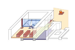
Part of it was subdivided into four small rooms or cells by walls.
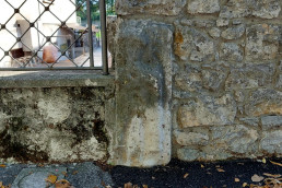
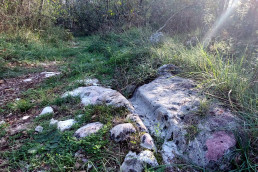
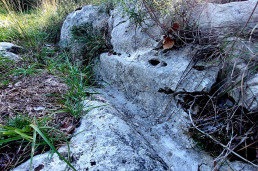
The discovery of a squared stone block with a central hole (D),juxtaposed to the perimeter wall of the housein correspondence with an external buttress, leads to the hypothesis that a post was inserted there to support a movable partition (e.g., a curtain): this would have allowed the room to be further divided, creating a sort of antechamber and preventing the view of the cells. Such elements suggest the transformation of this part of the villa into a sacellum, that is, a place intended for a domestic cult.
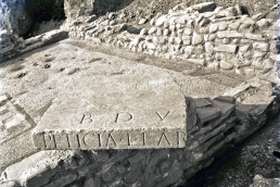
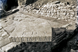
The room was entered from the courtyard through a door documented by the finding of a stone threshold (E) with hinge holes. This transformation into a sacellum is corroborated by the finding, in this room, of a large stone slab (dimensions preserved 57 x 57 cm), possibly a mensa, a kind of table for ritual offerings.
It bears engraved the inscription B(onae) D(eae) V(otum) / PETICIA L(uci) L(iberta) AR[-] testifying to the dissolution of a vow made by Peticia, a freedwoman (freed slave) of the Peticii family, to the Bona Dea.
The inscription is dated between the end of the first century B.C. and the first half of the first century A.D. and thus testifies that the cult to the Bona Dea was practiced in the Staranzano villa already during its first phase of establishment.
A large quadrangular platform was also found in the inner courtyard of the complex, paved with terracotta cubes, whose function or possible relationship to the sacellum is unknown.
The cult of Bona Deaera particularly widespread in the territory of Aquileia and was connoted as a mystery cult, practiced only by women, whose characters could not be known to men. Celebrations were held in public form in temples but also in private form inside homes; free women and enfranchised slaves participated.
The presence of the small cells in room A of the villa harkens back to sacred buildings dedicated aquesta deity salutifera, for example the temple of Bona Dea Subsaxana on the Aventine Hill in Rome or the one identified in the center of Trieste in 1910, where the cells were perhaps intended for the performance of divination activities or healing rites.
Understanding the architectural features of the Staranzano villa and reconstructing its phases of occupation are particularly problematic because of the paucity of everyday materials recovered during archaeological investigations, such as pottery and amphorae. Only stamped tiles and a few metal objects, such as a bronze net needle, are mentioned in the 1955 excavation diaries.
Ronchi Bridge
This imposing structure, most likely built at the turn of the first century B.C. and early first century A.D., was an important junction of the ancient road system in the area.
From historical sources we know that his remains were first unearthed around 1688 near the church of San Lorenzo di Ronchi, during gravel excavation work.
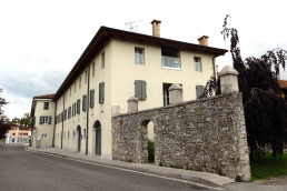
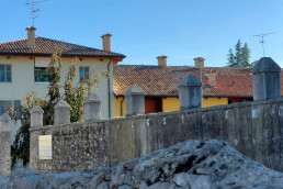
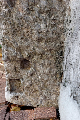
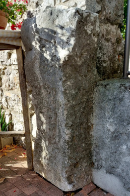
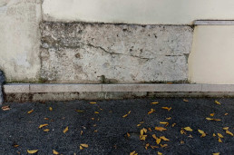
Most of the stone blocks that constituted its structural elements were removed over the centuries to be partly reused as building material, for example, in the bell tower of the disappeared church of San Poletto in Monfalcone, or in that of the church in Campolongo; other blocks, still visible today, were placed as decorative elements, on the boundary wall of the De Dottori villa in Ronchi dei Legionari.
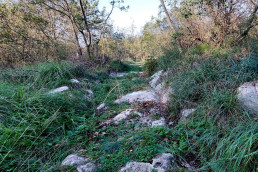
Today nothing remains visible of the bridge in situ; all we know of its conformation and the materials of which it was made up comes to us from analysis of the large amount of stone bocchi reused or heaped up near the area where it stood.
The structure, more than 200 meters long, was between 8 and 10 meters high, and was supported by six pylons; it crossed an ancient branch of the Isonzo River, now disappeared, that ran at the foot of the Karst.
In the Roman period, but at a time that cannot be specified, the bridge was renovated: tombstones or parts of funerary monuments, dating within the first half of the 1st century AD, were used for this purpose, probably coming from nearby necropolises that were located as usual along the communication routes.
Aquileia-Tergeste Road
This important road artery, described by ancient routes and identified by some scholars with the via Gemina, crossed the area between the Soča and Timavo rivers to head towards Tergeste (Trieste) and toward Pola in Istria.
From Aquileia it passed through the territory of San Canzian d'Isonzo and then in the vicinity of the villa of Staranzano; it joined other roadways near present-day Ronchi dei Legionari where a bridge over 200 meters long crossed an ancient riverbed of the Isonzo. The road then ran at the foot of the southern slope of the Monfalcone hills and continued toward Tergeste after crossing over a stone bridge over the Locavaz River. At the mouth of the Timavo was the Randaccio villa, which served as a rest station for travelers (mansio). Numerous sections of the road have been identified in the course of archaeological research and through the use of aerial photography; the discovery of funerary monuments, usually placed, in Roman times, along the road axes, has contributed to the reconstruction of the ancient road network in the area.
Bridge over the Locavaz River
The road that in Roman times led from Aquileia to Tergeste in the section east of Monfalcone ran along the coastline and crossed the Locavaz River on a bridge of which nothing remains visible today.
Alberto Puschi, director of the Trieste Civic Museum from 1884 to 1918, noted some of its elements in 1898. Speaking of the road he wrote that ... vestiges can still be seen across the marsh where it seems to lie on dam... referring to the then swamped area between the Lisert and the mouths of the Timavo River.
From his notes we know that the bridge, made of sandstone and limestone, had two arches.
The inscribed limestone block recovered in 1932 during reclamation work on theLisert marsh seems to be pertinent to it.
Membership LEG XIII mentions the 13th Gemine Legion whose soldiers would have been employed in the construction of the road and bridge or their rearrangement in the second half of the 1st century BC.
Randaccio's Villa
The villa, of which 40 rooms covering an area of about 1,300 square meters have been unearthed, is located within the park of the Trieste Aqueduct "Giovanni Randaccio" near the resurgences of the Timavo River.
The building's rooms were arranged on three levels partly exploiting the rocky slope of a karst high ground.
The excavation, made problematic by the constant rising of groundwater, allowed for the investigation of a sector of the residential part of the villa. It was founded by the middle of the first century B.C.E. and was modified four times: in the Augustan period (27 B.C.-14 A.D.) the floors of the rooms were covered with black and white mosaics with cross, star, lozenge, and crenellated wall motifs; in the third phase, between the end of the first and the beginning of the second century A.D., the villa was expanded and some rooms were equipped with floor and wall heating by means of cavities and pipes for the passage of air heated by a boiler.
In the last phase, between the 3rd and early 4th centuries AD, the building, already partly abandoned, was remodeled with the implantation of production-type structures (some tanks and a hearth).
The complex, because of its size and proximity to the road from Aquileia to Tergeste, has been interpreted as a mansio, i.e., as one of the rest stations for resting travelers and horses, located along the evenly spaced streets.
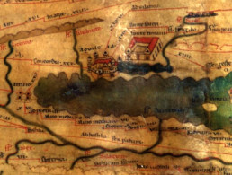
Scholars identify this mansio in the illustrated road station at the Fons Timavi at Tabula Peutingeriana, medieval copy of a painted itinerary from the Roman period (probably from the second half of the 4th century AD).
